Deboleena Sengupta
The borderland is not just a straight-line, but a way of life for the borderlanders—a space to adapt, reject and negotiate with the interests of two sovereign nations.
On 8 October 2016, my friend and I reached Chhit Bangla (also known as Chhit– Tiloi), which used to be a fragmented territory of Bangladesh that fell in India. This place currently overlaps Char Balabhut which falls under Tufangaj, a sub division of Cooch Behar district of West Bengal. Bits of the land are further fragmented at places by Dhubri district of Assam. The Char (meaning a sandbar or river island) is separated from the mainland by the ‘International waters’. Across the waters, in Chhit– Bangla we met a woman, introduced as Kaushinmoi Bewa, the sole inhabitant of the region, who lived there with her daughter.

[Kaushinmoi]
Me: Which place is this?
She: Andie (India)
Me: Do you vote for India?
She: I voted for the first time in this election.
Me: How does Indian government help you?
She: The government gave us two chickens. Sorkari Murgi!! (Govt. chickens)
…
Me: Can I stay here with you?
She: (spontaneously) Yes, why not?
Me: If not today, next time when I am here, this would be my place to stay?
She: I will not be here. We shift before the monsoon rains flood the place.

[Sarkari Murgi: Governmental Chicken]
Interestingly, Chhit (or an enclave) is a tiny piece of land which belonged to Bangladesh but remained in India, and vice versa. In 1947, after the demarcation of international borders, they had been landlocked with no legal access to the markets or even their own cultivated lands which fell on the other side of the borders. With no voting rights or primary health centers; no access to the public distribution system or rehabilitation package for the displaced people, their condition as such was that they could be considered de facto stateless (or abandoned zones). Besides, they were also not refugees, since they lived in the land which belonged to their own country.[i]
At the same time, nature has its own demands, as reflected in Kaushinmoi’s words. In their search for a place of shelter and a place to call home, and to escape the annual floods in the region, they often had to overlook the international borders. The feeling of homelessness was more fearful, than being disloyal to a state. Or rather, overlooking borders was more natural to them, than abiding by a European idea of state sovereignty that had been imposed on them in the mid- twentieth century.[ii]
To settle these geographical complexities, in May 2015, the 1974 Land Boundary Agreement (LBA) was passed. In accordance to the Agreement, India transferred 111 such enclaves to Bangladesh, while Bangladesh transferred 51 enclaves to India. The Agreement was implemented with the hope that swapping of lands was important to ‘mitigate the hardships that the residents of the enclaves have had to endure’.[iii]

During one of my field visits to Morigaon, a district of Assam bounded by the mighty Brahmaputra, I also witnessed how human migration in the region is a common sight. Every year large areas of the district are affected by floods and followed by land erosion. As a result of which, the population of some villages undergo sudden growth in number, when the river erodes nearby villages. Geographical complexity is therefore an inevitable reality. [i]I was curious as to how the administration deals with such complexities. To my query, a Gaon Panchayat secretary of a block of Morigaon promptly replied, “We do not face many problems due to it, until the question of allocation of fund is raised”.[ii] In other words, one does experience such administrative conflicts in the local level, but then, their borders are not as controlled (and volatile) as that of the international ones.[iii]
The reminiscence of a troubled past:
Back in nineteenth century, the Great Trigonometrical Survey (GTS) was introduced as a project, aimed to measure and map the entire Indian subcontinent with scientific precision.[iv] The GTS was however flawed in two senses: in the first place, the GTS was not in itself a complete survey of India, because it was driven by cash shortages and conflicting ideological concerns; secondly it was a highly negotiated process involving the differences in interests among surveyors, military overseers, the governors of India and the East India Company Board in London.[v]
In spite of these shortcomings, the GTS was supported by the Royal Society, as they had used mathematics and Newtonian mechanics. But then, no Newtonian science and mathematics could conquer the changing course of rivers, and the shifting homes of the people inhabiting the riverine islands. Such instances spoiled their efforts to capture an accurate survey.[vi]
When the time of partition arrived, the British government appointed an Englishman to divide the Indian subcontinent. Cyril Radcliffe who headed the Boundary Commission arrived in July 1947 and carried out the ‘superhuman feat’ to divide a country he had never seen before. He drew a straight line that ran between rivers, villages, houses and marketplaces. The formation of the enclaves was inevitable, because Radcliffe did not have ‘the right map to do it with’.[vii] Following on to which, the partition not only divided the Indian subcontinent, it was also a partition of human relationships, and a call for merciless bloodsheds in the name of nation making.

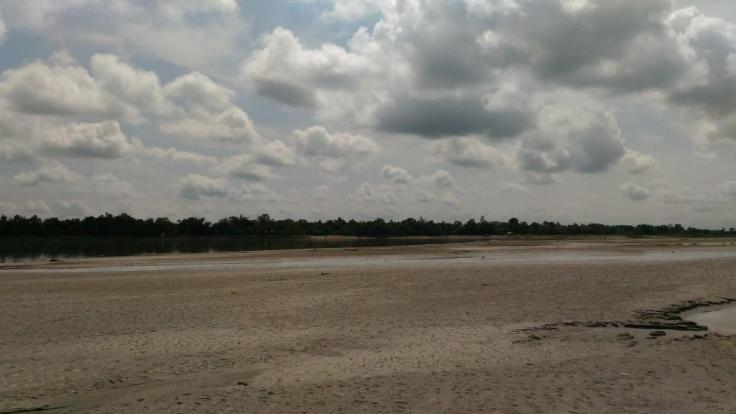
[International Waters]
Reflections from the enclave existences:
Kaushinmoi’s words do inform us that immigration or intrusion into a foreign space is an obvious reality for the people at the India-Bangladesh borders. One could also find a state authorized road that ran through the Bangladeshi enclave named Madhdha Moshaldanga in the Indian Territory, connecting three Border Security Forces’ (BSF) camps of India. The Indian BSF’s journey to the camps through the Bangladeshi enclave was the same intrusion (into a foreign space) which a non-citizen is restricted to.[i] If on the one hand, International conflicts are inevitable; occasions like the one mentioned above also highlight moments of negotiations between the state and the people in the enclaves.
However, when the suspicion driven notions of indigenous-foreigner binary, tagged with national anxiety, becomes the only rallying point, all other issues of deprivation and discord affecting the life and livelihood of the border people take the backseat. These are moments when hundreds of deaths and killings at the international border get justified, and the hatred of partition is ceremoniously celebrated in the name of ‘love’ for one’s nation.
[Deboleena Sengupta is a research scholar at Dibrugarh University, Assam. She can be reached at deboleenasengupta3@gmail.com. All photos and captions are by the author, and some are left deliberately uncaptioned by her.]
[i] Shewly, H. J. (2012), Life, the Law and the Politics of Abandonment: Everyday Geographies of the Enclaves in India and Bangladesh, Ph.D. Thesis, Durham: Durham University.
[i] In reference to the villages named Gagalmari, Ashigar and Galgamari Ashigar of Morigaon district, visited in 4th May 2017
[ii] Bhurbandha block visited in 18th May 2017
[iii] Banerjee, (2010), Borders, Histories, Existences:Gender and Beyond, New Delhi: Sage Publications
[iv] Edney, H. M. (1997), Mapping an Empire: The Geographical Construction of British India, 1765-1843, Chicago: University of Chicago Press.
[v] Edney, H. M. (1997), Mapping an Empire: The Geographical Construction of British India, 1765-1843, Chicago: University of Chicago Press.
[vi] Schendel, W. (2005), The Bengal Borderland: Beyond State and Nation in South Asia, London: Anthem Press.
[vii] Mosley, L. (1961), The last days of the British Raj, Jaico Publishing House, reprinted 1965
[i] Ghosh, A. (2015), “Chhitmahal: The Defacto Stateless of the Indo-Bangla Border”, Policies and Practices, 68
[ii] Schendel, W. (2005), The Bengal borderland: beyond state and nation in South Asia, London: Anthem Press.
[iii] * Government of India, India and Bangladesh Land Border Agreement, Ministry of External Affairs, New Delhi

The people of Chhit Taloi is a erstwhile Bangladeshi Enclave people. They have not shift their home from their home state (to which the enclave belongs ). They remain in-situ in India (host state). Now (after 1st August 2015) they are the citizens of India. Only the 981 people from Indian enclaves in Bangladesh returned to India live in three rehabilitation camp (Dinhata, Mekhliganj and Haldibari) are shifts their home with a great disappointment.
LikeLike
Hi Mukul, I thank you for your response.
By ‘shifting homes’, I do not only mean the process of swapping national territories as a result of LBA 2015, but I have tried to look at the human migrations which take place when it gets impossible for people to live in the place they have been calling a home. And then how these migrations take an all new face when people are located in different kinds of borders(as I have put a case of Morigaon too– an example of migration within state borders in contradiction to the international borders)?
I hope my point clarifies the article to you. 🙂
I thank you for the information that you have provided. Please stay in touch so that I can improve my work.
LikeLike